|
THE HISTORY OF CLEVELAND ____________ CHAPTER I IN THE WESTERN WILDERNESS "While I was in New Connecticut I laid out a town, on the bank of Lake Erie, which was called by my name, and I believe the child is now born that may live to see that place as large as Old Windham." These are the words in which Moses Cleaveland, in the year 1796, recorded a prophecy that has been abundantly fulfilled. Staid Old Windham, where for many years Connecticut justice held the scales with rigid exactness, was then far in advance of the newly-named town upon the Cuyahoga, which existed only upon the surveyors� charts, and in the prophetic vision of its founder. Staid Old Windham lies to-day in the quiet usefulness of villagehood, while the city by Lake Erie is well counted one of the great commercial centers of the West. Could Moses Cleaveland stand for a moment, in this memorable centennial year, where his figure in bronze keeps ward over the city where his memory is so highly honored, he would realize that he had builded well, and left an impress for all time upon the life and development of this fair portion of his native land. It is a romantic story that we have to tell of the men and women who came into the wooded wilderness on the shores of Erie, one hundred years ago and brought with them the ideas and principles that had even then made New England a power in the moral world�who faced danger, and withheld themselves from no labor that stood between them and the creation of a home. This story can never be told in that completeness of incident which is the very essence of romantic history, but enough has been written or related by those who had a part therein to make one of the most entertaining chapters upon the opening of the West. Privation, toil and danger were in the wilderness in those days, as the long war between civilization and savagery went on. While the Western Reserve had its share of death and disaster, the valley of the Cuyahoga was never drenched in blood as was that of the Mohawk or the Kentucky; therefore, the story of Cleveland has no record of sack or pillage, but it has much to tell of want and labor, of a patient sowing of seed that we of a later day might reap, of brave men and helpful women. It is a record of the successive steps by which the New England of the East gave of her brain and sinew for the building of the New England of the West. A striking picture in this panoramic view was made when General Cleaveland, upon that fair day in July, stood on the hills overlooking the Cuyahoga and Lake Erie, and realized that the end of his journey and the beginning of his real labor of planning and construction had come together at that point and in that hour. Could this energetic New Englander have looked into the past, as he scanned the wooded heights and the green-edged valley, he would have seen a wonderful chain of events that led back to the beginnings of time, and of which we know only by the traces left upon the rocks and in the soil�by the marking fingers of ice, of flood and of fire. Those who have studied these lessons, as they lie upon the surface or beneath the soil, from the gorges of Rocky River to the ledges of Nelson, tell us that there was a time when Lake Erie had not made a beginning among the water highways of the world; when its bed was a wide and nearly level plain, with one river, or perhaps two, flowing through it. There was little soil upon the country roundabout, and the streams were deepened wide--the valley of the Cuyahoga lying, perhaps, one hundred and fifty feet or more deeper than it does today. A marvelous movement of nature then occurred and wonderful changes followed in its wake. Nearly all the North was covered with a continent of ice, which moved in a southerly direction, carrying stones and soil in great quantities, and leaving the country far more fertile than it was before. "The Ice Age," we are told by one1 who has added so much to our knowledge of past events, "brought to your vicinity the first pioneers from another country, your boulders. . . . . While this was going on, a little south of the ice, streams were depositing gravel, and deep in that gravel, deposited when it was laid, are the undoubted implements of glacial man, following up the ice. What may be found of him, here, as the ice retreated, is not known, but it may safely be presumed that the earliest known man knew something of your vicinity. His tools of flint, chert or argillite were very simple and few. His learning was of the slightest. His mark upon the earth was so small that high authority believes that some catastrophe overwhelmed him altogether; but perhaps it only happened that some civilized man raised him at once to a higher civilization, perhaps in a service condition. "After the Ohio had broken the dam at Cincinnati2 and regained its former channel; after the plateaus had been formed and the surface of Ohio became as it is at present, there appeared a new man, the Mound Builder. . . . . Weapons and tools of rubbed and chipped stone, copper pounded but not case, and galena not melted to lead, though both were sometimes placed on funeral pyres, unglazed pottery, no burned bricks, no stone buildings; using baskets to carry dirt, making a very coarse cloth or matting, having no alphabet; they must have been industrious and agricultural or they could not have built such immense works. Living mainly on corn, with a government strong enough to combine them patiently, probably through priestly superstition, their civilization was not higher than some Indians when America was discovered. . . . . There is no satisfactory evidence of any intermediate race between the Mound builders and the modern northern Indians."3 There is a wide space to travel, between the writing of these records upon the rocks or their burial beneath the soil, and those left in oral relation or script by men of whose existence we are certain, and whose labors can be historically recorded. Among the earliest glimmers of knowledge of the movements of the white man upon this southern shore of Lake Erie may be placed the visit of Father La Roche Daillon, a Recollect missionary, who as early as 1626 preached to an aboriginal people, by some called the Kakquahs, and by the French the "Neuter Nation." The headquarters of this tribe, or nation, were probably upon the north shore of Erie, although they had villages near the present site of Buffalo, and extending westward along the shore of the lake. Such information, as this Father has left us leads to the belief that, at that time, the southern shore of Lake Erie, say from Cat- araugus Creek, in New York, to near Sandusky Bay, Ohio, was occupied y a powerful tribe known as the Erie.4 In blood, they were kindred to the Iroquois, a fierce and implacable foel who, near 1650, waged war upon the Kakquahs, and followed this by a warfare so fierce and merciless upon the Eries that they were practically swept from the face of the earth. Whole families were slaughtered, and villages burned to the ground; some who escaped joined the tribes of the farther West; children were captured and held for adoption, and warriors, who were taken in battle, were reserved for torture. This sudden and savage extinction of the Eries left northeastern Ohio in the hands of the powerful Iroquois. Their western boundary was set along the Cuyahoga, while their war parties made occasional excursions beyond.
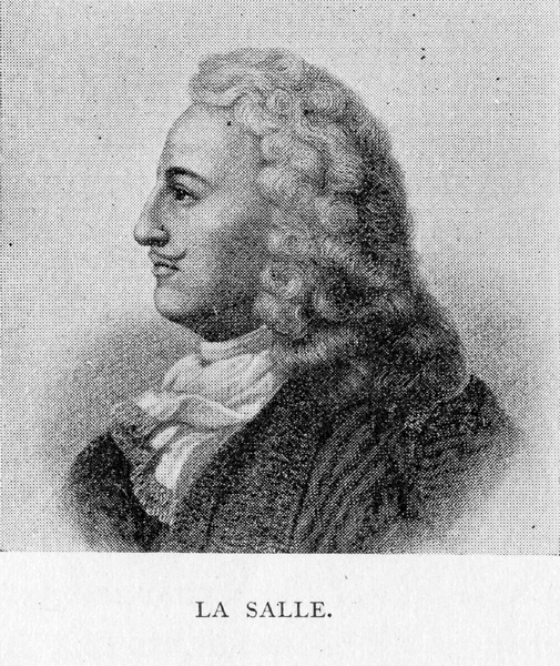
There is little definite information as to the year in which the French traders appeared among the Indian tribes of this section. There is evidence to show that that remarkable explorer and adventurer, La Salle, was in the country south of the Erie as early as 1669; discovered the Ohio River,5 and passed down it as far as the site of Louis- ville, where he was abandoned by his men, and compelled to return home along. There is a map, of which there is some evidence to show that he was the author, bearing the date 1672, where the fair body of water to the north of us is called "Lake Tejocharonting, commonly called Lake Erie." We begin to tread upon firmer ground, in considering the records of but a few years later. In 1678, La Salle was commissioned by Louis XIV. of France to explore that part of the western wilderness of America called "New France." His purpose was threefold: "To realize the old plan of Champlain, the finding of a pathway to China across the American continent. To occupy and develop the regions of the northern lakes. To descend the Mississippi River and establish a fortified post at its mouth, thus securing an outlet for the trade of the interior, and checking the progress of Spain on the Gulf of Mexico." In the early part of 1679, he built above the falls of the Niagara a vessel of sixty tons, which he names the "Griffin," and in which he sailed out into the waters of the Erie. Shipwreck and disaster were the fate of this first vessel of the white man to spread her sails upon these inland seas. She reached Green Bay, where LaSalle and some of his lieutenants left her, was loaded with furs, set out upon her return trip, and was never heard of again.6 During the years in which the French and English carried on their long dispute as to the ownership of this portion of the West, that part east of the Cuyahoga remained in possession of the Six Nations, who used it as hunting ground; while that to the west of the stream was in the main under the control of the Ottawas, Chippewas and Pottawattomies, their only white visitors being an occasional French or English fur-trader, or a zealous Jesuit missionary, who had braved the manifold dangers of the venture for the advancement lf his faith. For better understanding of that which immediately follows, it will be necessary to bear in mind the fact that at the beginning of the Eighteenth Century there were three great European powers who claimed possessions in North America. Spain was the master of Mexico and of a portion of the southeast corner of the United States; France held all to the north of the lakes, west of the Alleghanies, and southward to the possessions of Spain; while England�s claims went from the Spanish line on the south to the northern lakes and the St. Lawrence, and westward to the Alleghanies. These are the general outlines. There were disputes in several directions as to boundary lines, which in many cases were but faintly outlined. In 1714, Governor Spotswood, of Virginia, led an expedition which disproved the general belief that the Alleghanies were impassable. He passed the chain and descended to the Ohio.7 Upon his return he in-
formed those who were his superiors in authority, the British Ministry, that the planting of a settlement in the western valley was a matter of great importance, and that England�s interest did not lie in permitting France to hold it in undisputed possession. England moved forward in her conquests, slowly but surely. She gained the friendship of the great Iroquois Confederacy�the most powerful organization of Indian tribes in the New World�who were in possession of the southern shores of Lakes Erie and Ontario.8 Many treaties were made with these confederated tribes during the first half of the Eighteenth Century, and grants of lands of great value were obtained on the eastern slope of the Mississippi Valley. It was near the middle of that century when England acted upon the wise advice of her Virginian governor. An organization known as "The Ohio Company" was created in 1748, which received a royal grant of one half million acres of land in the valley of the Ohio. The endeavors of this company to obtain and hold secure their new possessions continued for years, and form a chapter of absorbing interest in the history of Ohio, but have no direct connection with the valley of the Cuyahoga. A long step toward the secure possession of this great empire of the West was taken when, by the treaty of Paris, made in 1763, England acquired Canada and all the territory east of the Mississippi and southward to the Spanish Territory, with the exception of New Orleans and its immediate vicinity. This was followed, in 1768, By a treaty at Fort Stanwix, between Sir William Johnson and the Six Nations, by which the lands south of the Ohio and the Alleghany were sold to the British, the Indians still retaining those north and west of these rivers. The white men who ventured into the lands to the south of Lake Erie and west of the Alleghanies, previous to the organized attempts at settlement made to the south by the Ohio Company and to the north by the Connecticut Land Company, have left few traces by which their purposes can be clearly understood, or their movements closely followed. The hardy and venturesome trader, both English and French, who pushed into the wilderness, and carried the products of civilization to exchange for those of the chase, reached the mouth of the Cuyahoga at an early day. The French extended their forts and trading posts to many points on the lakes and the Ohio River, between 1700 and 1750. In this year last named they possessed a fort at Sandusky, and five years later a trading house on the Cuyahoga, near the mouth of Tinker�s Creek. The winter of 1755-6 was spent by James Smith, a Pennsylvanian, in this neighborhood, as a prisoner of the Delawares, and in a narrative which he penned the sections watered by the Cuyahoga, the Black and the Kilbuck rivers are fully described. Near the same time a white girl named Mary Campbell passed five years in a like captivity near the Cuyahoga falls, not far from the site of Akron. In commenting upon the early traders who pushed forward to this neighborhood, Colonel Charles Whittlesey says: "After the British took possession in 1760, French and English traders continued together to traffic with the Indians on the waters of Lake Erie. No doubt a post was kept up at some point or points on the river during the large part of the Eighteenth Century, but such establishments are so slight and temporary that they are seldom noticed in history. A trading house is a very transient affair. A small log cabin covered with bark constituted all of what is designated as an establishment. If the Indian customers remove, the
trader follows them, abandons his cabin, and constructs another at a more convenient place. Within a year the deserted hut is burned to the ground, and all that remains is a vacancy of an acre or two in the forest covered with grass, weeds, briers and bushes."9 In 1760, Major Robert Rogers, in command of a New Hampshire company of Provincial Rangers, left Fort Niagara to take possession of the French post. According to one eminent historian,10 they paid a visit to this place: "On the 7th of November, 1760, they reached the mouth of the Cuyahoga River, the present site of Cleveland. No body of British troops had ever advanced so far. The day was dull and rainy, and resolving to rest until the weather should improve, Rogers ordered his men to prepare their camp in the neighboring forest. The place has seen strange changes since that day. Soon after the arrival of the Rangers, a party of Indian chiefs and warriors entered the camp. They proclaimed themselves an embassy from Pontiac, ruler of all that country, and directed in his name that the English should advance no further until they had had an interview with the great chief, who was close at hand. He greeted Rogers with the haughty demand, what his business was in that country, and how he dared enter it without his permission." After parleying and presents, the objection was withdrawn. In the opinion of Col. Whittlesey, this reported interview did not occur here at all, but at Grand River. An expedition sent out under Major Wilkins, in 1763, was wrecked on Lake Erie near the Cuyahoga, or Rocky River, and was so disorganized that it had to return; while yet another under Col. Bradstreet (1764) is supposed to have passed through this neighborhood. Sir William Johnson, the superintendent of Indian affairs, paid a visit to Detroit in 1761, after the English had obtained possession of that Place, and returned home by way of the south shore; in his diary we find this Record: "Embarked this morning at six of ye clock, and intend to beach near Cuyahoga this day." As early as 1765 the practical eye of Benjamin Franklin, as he scanned the crude maps of the Western country, and listened to those who had visited it, showed him the advantages of the Cuyahoga as a military post, and he recommended its occupancy for that purpose. Washington himself, in discussing the question of water communication between the northern lakes and Chesapeake Bay, suggested "the practicability of a route from Lake Erie by way of the Cuyahoga. Tuscarawas and Muskingum into the Ohio, as an outlet to future inland commerce of the lakes." Necessitating "a portage near Akron of less than seven miles, whereby shipments were to be transferred from the lakes to the river Ohio, thence to ascend its upper tributaries into the mountains, from whence, by another portage, would be reached the navigable rivers falling into the Atlantic."11 In the fall of 1782, the mouth of the Cuyahoga again appeared in the discussions of the military authorities, and there occurred an incident of travel and suffering in an endeavor to reach it, that so well illustrates the conditions then existing, that I am led to relate it with some detail. The newly-created American Government had learned that the British had established a military post at Sandusky, and were about to build another, either at Cuyahoga or Grand River. Major Isaac Craig, of the Revolutionary Army, was ordered to take Lieutenant Rose and six active men, visit the two points last named, and learn "whether any such attempts were making by the enemy."12 The little party set forth from Fort Pitt (Pittsburg) upon its long and perilous journey, near the middle of November, in the year named. They reached a point they sup-
posed to be within a day�s march of the Cuyahoga, and there left one man in charge of their extra provisions, it being their intention, upon rejoining him, to take a fresh supply and then proceed to a like visit to the mouth of the Grand. We quote from the narrative as learned from Major Craig: "The weather proved very unfavorable after the separation; the Major, with his party, was detained beyond the appointed time, and the soldier with the horse had disappeared, so that when they reached the designated place, weary and half-famished, they found no relief, and had before them a journey of more than one hundred miles, through a hostile wilderness. The examination of the Grand River had of course to be abandoned, and the party was compelled to hasten back to Fort Pitt. The travel back was laborious and painful, the weather being tempestuous and variable. The party pursued the most direct course homeward. Before they reached the Conequenessing, near about, as Major Craig thought, where Old Harmony now stands, the weather became extremely cold, and they found that stream frozen over, but the ice not sufficiently firm to bear the weight of a man. The following expedient was then resorted to as the best the circumstances allowed: A large fire was kindled on the northern bank of the Conequenessing, and when it was burning freely, the party stripped off their clothes; one man took a heavy bludgeon in his hands to break the way, while each of the others followed with portions of the clothing, and arms in one hand and a fire-brand in the other. Upon reaching the southern bank of the stream, these brands were placed together and a brisk fire soon raised, by which the party dressed themselves and then resumed their toilsome march. Upon reaching the Cranberry plains, they were delighted to find encamped there a hunting party consisting of Captain Uriah Springer and other officers, and some soldiers from the fort. There, of course, they were welcomed and kindly treated, and arrived at the fort on the evening of the second of December. The report of Major Craig was that there was no sign of occupancy at the mouth of the Cuyahoga." The residence of the Moravian missionaries13 and their followers within the present boundaries of Cuyahoga County was brief and unimportant, except as a chapter in the long, sad story of that driven and persecuted people. When the "praying" Indians and their white leaders decided to leave their temporary home in Michigan, they determined, in May 1786, to "plant a settlement" on the Cuyahoga River, and after much toil and many disasters reached a point upon its eastern bank, a short distance below the mouth of Tinker�s Creek. To this location they gave the name "Pilgerruh" or "Pilgrim�s Rest." By October they had so far completed their village as to give them comfortable shelter for the winter. In the spring of 1787, they prepared to move westward, to the mouth of Black River, and on April 19th the last prayer was heard in their little chapel at "Pilgrim�s Rest," after which they commenced anew the journeyings, some going overland, and others in canoes by way of the Cuyahoga and Lake Erie. Very little in the way of detail touching the experiences of these people upon our home-soil has been bequeathed to us.
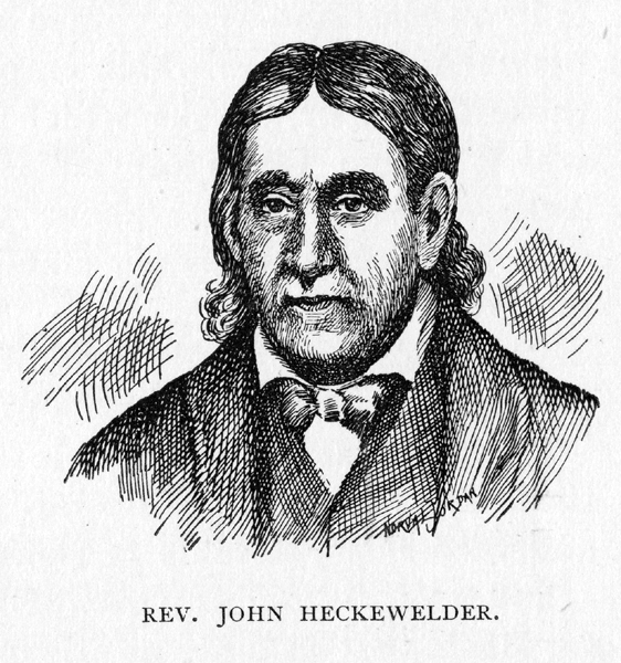
There is in existence, however, among the rich possessions of the Western Reserve Historical Society�presented by a daughter of Moses Cleaveland�a map and a manuscript descriptive of the same, prepared in 1796 by the Rev. John Hecke- welder, a leading Moravian missionary, who came to the Cuyahoga valley with his people, but left them before the opening of the winter. This map covers the country from the Alleghany River on the east, the Ohio on the south, the lake on the north, and the Huron and Muskingum on the west, and is, of course, crude and uncertain in both outlines and details. His manuscript bears the heading: "Description of that part of the Western Country comprehended in my map; with remarks on certain particular spots, etc." We quote some of these remarks as follows: "Altho the country in general containeth both Arable Land & good Pasturage: yet there are particular Spots far preferable to others: not only on account of the Land being here superior in quality: but also on account of the many advantages presenting themselves. "As the first place if utility between the Pennsylvania Line: (yea I may say between Presq� Isle) and Cujahaga; & in an East and West course as the dividing Ridge runs between the Rivers which empty into the Lake Erie; & those Rivers or Creeks which empty into the Ohio: (&which Ridge I suppose runs nearly Paralell with this Lake, & is nearly or about 50 miles distance from the same): Cujahaga certainly stands foremost; & that for the following reasons. "1. because it admits small Sloops into its mouth from the Lake, and affords them a good Harbour. "2. because it is Navigable at all times with Canoes to the Falls, a distance of upwards of 60 Miles by Water--and the Boats at some Seasons of the Year to that place�and may without any great Expense by made Navigable for Boats that distance at all times. "3. because there is the best prospect of Water communication from Lake Erie into the Ohio, by way of Cujahaga & Muskingum Rivers; The carrying place being the shortest of all carrying places, which interlock with each other, & at most not above 4 miles. "4. because of the Fishery which may be erected at Its mouth, a place to which the White Fish of the Lake resort in the Spring, in order to Spawn. "5. because there is a great deal of Land of the first Quality on this River. "6. because not only the River itself, has a clear & lively current, but all Waters & Springs emptying in the same, prove by their clearness & current, that it must be a healthy Country in general. "7. because one principle Land Road, not only from the Allegheny River & French Creek: but also from Pittsburg will pass thro that Country to Detroit, it being by far the most level Land path to that place." In further description of this wonderful section that has so captivated the eye of this visitor and laid its impress upon his judgment, Mr. Heckewelder adds that the "Land on the Cujahaga River itself is good, and well Timbered either with Oaks & Hickory, or with lofty Chestnuts. The Cujahaga Country abounds in Game, such as Elk, Deer, Turkey, Raccoons & ." In conclusion he inserts "the description of the late Georgrapher to the United States gives to this part of the Country, copied from a Pamphlet he had printed in London in the year 1778"�the main point of which is the statement that "Cujahage will hereafter be a place of great importance." Well, indeed, has that prophecy, made eighteen years before Moses Cleaveland set foot upon this soil, been fulfilled. Mention of this Moravian town is made by a traveler who visited the Cuyahoga in 1786. Col. James Hillman, of Youngstown, Ohio, in writing to Judge Barr, under date of November 23rd, 1843, says: "In the spring of 1786 Messrs. Duncan & Wilson entered into a contract with Messrs. Caldwell & Elliott, of Detroit, to deliver a quantity of four and bacon at the mouth of the Cuyahoga River, to a man by the name of James Hawder, an Englishman, who had a tent at the mouth of the river, for the purpose of receiving it. In May, 1786, I engaged with Duncan & Wilson, at Pittsburgh, as a packhorseman, and started immediately. We took the Indian trail for Sandusky, until we arrived at the Standing Stone, on the Cuyahoga, a little below the mouth of Breakneck Creek where the village of Franklin is now. There we left the Sandusky trail, and took one direct to the mouth of Tinker�s Creek, where was a little town built by Heckewelder and Zersberger, with a number of Moravian Indians. They were Moravian preachers. Here we crossed the Cuyahoga, and went down on the west side to the mouth. In going down we passed a small log trading house, where one Meginnes traded with the Indians. . . . The mouth of the Cuyahoga was then about the same as when I last saw it, in 1813. In 1786, there was a pond of water west of the mouth, which we called Sun Fish Pond, where we caught sun fish. We carried axes to cut our wood and I remember we at one time undertook to open the mouth of the river, which was choked up with sand. We made wooden shovels, and began to dig away the sand until the water ran through, which took away the sand so fast that our party was divided, a portion being left on the east side, where Cleveland now is. . . We made collars of our blankets for some of the horses, and took our tent ropes, made of raw elk skin, for tugs, drew small logs and built a hut at the spring, which I believe was the first house built on the Cleveland side." A little later glance at the physical outline of the Cuyahoga valley may be taken before passing on to the real narrative of the founding and building of Cleveland. A traveler14 writing as late as 1805, when he early settlers were already in possession, says: "The Cuyahoga empties into Lake Erie by a mouth eighty-eight yards wide, and is Navigable for sloops for fifteen miles without any falls or swift water; but there is a bar at the mouth like that of Grand river. In high water it is boatable sixty miles to the portage, which is seven and an half miles, to the head waters of the Tuscarawa branch of the Muskingum. Here are fine uplands, extensive meadows, oak and mulberry trees fit for ship building, and walnut, chestnut and poplar trees suitable for domestic services. Near the mouth of this river are the celebrated rocks which project over the lake. They are several miles in length and rise forty or fifty feet perpendicular out of the water. Some parts of them consist of several strata of different colors, lying in a horizontal direction, and so exactly parallel that they resemble the work of art. The view from the land is grand, but the water presents the most magnificent prospect of this sublime work of nature: it is attended, however, with great danger, for, if the least storm arises, the force of the surf is such that no vessel can escape being dashed to pieces against the rocks. The heathen Indians, when they pass this impending danger, offer a sacrifice of tobacco to the water." When the War of the Revolution ended in the triumphant success of the colonies, and civilization began to push westward with a new vigor, conflicting claims arose as to the ownership of various portions of the West.15 This portion of the lake region was included with the rest. Years before, while Connecticut was still a colony of England, she had acquired by grant from King Charles II, a great range of territory lying between the same parallels as those which bounded herself and extending "from sea to sea�from the Atlantic to the Pacific. When she became a State of the American Union she held to her claim Of dominion over this vast territory.16 That portion of this claim which crossed the territory of New York and Pennsylvania was extinguished by agreement among the commonwealths concerned, while that west of Pennsylvania was left in dispute until on September 14th, 1786, when she ceded it all to the United States,17 except that portion lying between the parallels of forty-one and forty-two degrees, two minutes, and a line one hundred and twenty miles west of the western line of Pennsylvania, and parallel with it. This tract was called "New Connecticut," or the Western Reserve, and it was decided to place the lands upon the market. Some steps toward the purchase of that portion of the Reserve upon which Cleveland stands wee taken in 1788, when a company was formed under General Samuel H. Parsons, who located a tract embracing a quarter of a township, but no surveys were made here under his patent. The Legislature of Connecticut, in 1792, granted to such of her citizens as had suffered by fire or otherwise, at the hands of the British, during the Revolution, one half million acres from the western end of this "reserved" tract, and that section was thereafter know as "The Fire Lands." A further step toward the disposal of her Western possessions was taken by Connecticut in May, 1795, when she appointed a committee to receive any proposals that might be made "for the purchase of the lands belonging to this State lying west of the west line of Pennsylvania as claimed by said State . . . to form and complete any contract or contracts for the sale of said lands." Eight men, representing the eight counties of Connecticut, entered into contracts with various individuals, for the sale of three million acres of the Reserve, for one million two hundred thousand dollars, or a cost of forty center per acre. These deeds were quitclaims only, the State guaranteeing nothing as against such Indian titles as still remained unextinguished..18 The holders of these deeds formed themselves into an organization called the "Connecticut Land Company," and for convenience in the transaction of business, conveyed their respective interests to three trustees: John Caldwell, John Morgan and Jonathan Brace. The management of affairs was left to a board if seven directors: Oliver Phelps, Henry Champion, Moses Cleaveland, Samuel W. Johnson, Ephraim Kirby, Samuel Mather, Jr., and Roger Newbury. Elaborate "articles of association and agreement "were drawn up. The annual meetings of the company were to be held in Hartford, Conn., in October, from whence the affairs of New Connecticut were to be managed. It was determined that the Indian titles should be extinguished, and the land surveyed into townships of five miles square. The proprietors were to club together, and draw by townships, after which the owners were to receive deeds and make their own subdivisions, In the first drat, $12,903.23 of purchase money represented a township. The next thing in this rapidly moving series of events was to push the surveys preliminary to sale and settlement. In the articles of association above referred to, the directors were authorized "to procure an extinguishment of the Indian title to said Reserve. . . . To survey the whole of said Reserve, and to lay the same out into townships containing sixteen thousand acres each; to fix on a township in which the first settlement shall be made, to survey that township into small lots in such manner as they shall think proper, and to sell and dispose of said lots to actual settlers only; to erect in said township and saw-mill and grist-mill at the expense of said company, to lay out and sell five other townships of sixteen thousand acres each to actual settlers only," When the directors, in accordance with these instructions, cast about for someone into shoes hands should be committed the opening of this great far Western wilderness which had come under their control, their choice fell upon one of their number�a man of education, legal attainments, military experience, and of good, sturdy stock. He was in the prime of life, and eminently fitted for the responsible labors before him; and as he was a member of the company, and one of its directors, his interest was that of his employers. This newly-chosen superintendent of the agents and men sent to survey and make locations on said land, whose name has become so closely linked with the fortunes of this great city of the Middle West, was Moses Cleaveland.19 The family from which he came was of no mean origin. The name comes from the Saxon, and before the Norman conquest was borne by a prominent family in Yorkshire, England. "An antiquarian of repute," writes one who has made the personal career of the founder of Cleveland a close and loving study,20 "states that William Cleveland, of York, England, who died at Hinckley, in Leicestershire, in 1630, was the remote ancestor of the American Clevelands. It is also shown that a lineal descendant of his, whose name was Moses, and who was a housewright, or builder, by grade, emigrated from England and landed at Boston in the year 1635, where he remained for several years. He then, in connection with Edward Winn and others, founded the town of Woburn, Massachusetts, where both he and Winn permanently settled. This Moses Cleveland was a man of intelligence and enterprise. He aspired to full citizenship and became in 1643, what was then called a �freeman.� The qualifications of a �freeman� required that he should be of �godly walk and conversation, at least twenty-one years of age, take an oath of allegiance to the government of Massachusetts Bay Colony, be worth two hundred pounds, and consent to hold office if elected or pay a fine of forty shillings, and vote at all elections or pay the same fine.� The restrictions and conditions were so onerous that many who wee eligible preferred not to become freemen, being more free as they were. But this Moses, who had now become a freeman, feeling that he had ancestral blood in his veins of a superior quality, thought that it ought to be transmitted, and after a brief courtship married, in 1648, Anne Winn, the daughter of his friend, Edward Winn, of Woburn. In taking this step, �Moses� did not make a mistake. The result was that he became the accredited progenitor of all the Clevelands born in the United States�a race not only numerous, but noted for great moral worth and many noble traits of character." That later Moses Cleaveland, with whom this inquiry if directly concerned, was born on January 29th, 1754, in Canterbury, Windham County, Connecticut. He was the second son of Aaron Cleaveland and Thankful Paine. They were refined, intelligent people, who decided that the son, Moses, should receive an education, and after the usual preparation he was sent to Yale College, from which he was graduated in 1777. He studied for the bar, and upon admission, began the practice of the law in his native town. No small degree of professional success was permitted him, yet within two years his attention was turned in another direction, by his acceptance of a commission as captain of Sappers and Miners, in the Army of the United States.21 Within a short time he resigned this commission and returned to law. He served as a member of the Connecticut Legislature several terms, and made an honorable record in that capacity. In 1794, he was married to Esther, daughter of Henry Champion, who is spoken of as "a young lady of rare accomplishments." He served in various capacities in the militia of the State, and early in 1796 became general of the Fifth Brigade. General Cleaveland�s connection with the Connecticut Land Company, and his experiences upon the Western Reserve, are related elsewhere at their proper place in this narrative. He continued his useful life, after his return from the West, until November 16th, 1806,22 when at Canterbury, Connecticut, he laid down his duties forever. His life and achievements are well summarized by Mr. Rice, who says: "Whatever else may be said of General Cleaveland, it is evident that he not only led an honorable life, but achieved a great work. He was a man of few words and of prompt action. His morality was an outgrowth of Puritanism and as rigid as it was pure. He was manly and dignified in his bearing, and so sedate in his looks that strangers often took him for a clergyman. In complexion he was somewhat swarthy, so much so that the Indians claimed him as akin to their own race. In personal appearance he was of medium height, erect, thick-set and portly, had black hair, a quick, penetrating eye, muscular limbs, and a military air in his step, indicating that he was born to command. In the social circle he was pleasant and agreeable in his style of manners, and was always received as a welcome guest. He was a friend to everybody, and everybody seemed to be his friend. In his opinions he was decisive, and could readily give a logical reason for them. He was also a man of true courage amid threatening dangers, and as shrewd in his tactics and management as he was courageous. . . . His was not only a career of unusual interest, but a mission that transformed a wilderness into a civilized land. In a word, his life-work commands our admiration and deserves commemoration."23 The instructions conveyed to General Cleaveland were general in their character, leaving a wide latitude to his discretion and his judgment in meeting the exigencies of the occasion. He was to superintend the surveys, and "to make and enter into friendly negotiations with the natives who are on said land, or contiguous thereto, and may have any pretended claim to the same, and secure such friendly intercourse amongst them as will establish peace, quiet and safety to the survey and settlement of such lands not ceded by the natives under the authority of the United States." He was further "fully authorized and empowered to act and transact all the above business in as full and ample a manner as we ourselves would do; to Make contracts on the foregoing matters, in our behalf and stead, and make such drafts on our treasury as may be necessary to accomplish the foregoing objects of your appointment." This elastic and comprehensive commission was issued on May 12th, 1796, and so expeditious was the stirring man in charge, that by May 19th we find him in Albany, N. Y., making active preparations for an early advance upon the West. On that date he wrote to Oliver Phelps, chairman of the board of directors, in a not altogether cheerful streain:24
"Albany, May 19, 1796. "I have in rain and bad roads arrived at this place. Mr. Porter left Schenectady on last Sunday, one man was drowned. I find it inconvenient and at present impossible to obtain a loan of money without sacrifice, as our credit as a company is not yet sufficiently known. It must then rest on drafts on Thos. Mather & Company, dependent on their early being supplied with money from Hartford. . . . Mr. Porter has proceeded, as I obtain information, with all the dispatch and attention possible, but we shall all fall short, tho� our exertions are ever so great, without pecuniary aid. I have concluded, without adequate supply , to proceed, and as my presence is much wanted to risqué consequences, shall make drafts on Thos. Mather and Company, resting assured that you will immediately, if at the expense of a person on purpose send on the money immediately that can be procured, to Messrs. Mather, who will attend to all orders and directions you may please to give. A credit once established, the business can with great ease and less expense be transacted, but if we shall be obliged to draw orders, and once protested, I am apprehensive that consequences will be fatal, at least to the persons employed." Affairs were so far carried successfully forward that early in the succeeding June the expedition was concentrated at Schenectady. A list of the officers and men employed was as follows:25 Moses Cleaveland, superintendent. EMPLOYEES OF THE COMPANY.
Daniel Shulay. TABLE OF CONTENTS | NEXT CHAPTER
|